August 22, 2015 – Dawson City to Whitehorse
On Thursday morning, we had one last stop before we departed from Dawson City, and that was to pay a visit to the Robert Service cabin. Sandy’s father, Wilf, could recite a number of Robert Service poems, and he would have loved to see that spot.
Luckily, though the sky was still overcast, it was high cloud, and we had no rain between Dawson City and Carmacks – our Thursday night stop. Carmacks had its history, like Nanaimo, in coal mining. The Yukon River flows powerfully past the town, which has a hotel, a small community on one side of the river, a First Nation community on the other, and a wonderful wooden walkway along the south side of the river. We found our RV parking site behind the hotel, and then trod the length of the walkway. A planned “Asian Buffet” at the hotel turned out to be a noon-time show, so we disappointedly ate à la carte.
On Friday, we had a short run (less than 2 hours) to Whitehorse. The day started out with fog to our north, and clear skies and chilly temperatures as we headed south. (At one point the temperature was down to -1C). We passed several beautiful, long lakes (actually, widenings of the Yukon River, I believe). Each lake that we passed had its own fog bank hanging over it. The first two were Little Fox Lake and Fox Lake, and then…
We came to the marge of Lake LaBarge, where we turned to our left to admire,
And stepped out of our truck to try our luck at finding the site of the pyre
Where Sam got heated, and thus the cold cheated, as he burned to a crisp in the fire.
There are strange things done in the midnight sun…!
Enough Robert Service? I think so!
By 10:30 we were in Whitehorse under clear skies, and after stopping in at the Visitors’ Centre, we booked our spot at Hi Country RV, and drove back into town to explore, and to meet an old friend of mine from my Vancouver days of 40 years ago – Hilary Preston (née Deasley). Hilary took us on an extended hiking trip along the Yukon River past the dam, up to a scenic hilltop view, and back along the east side of the River to the paddle wheeler where we were parked. Later, we joined the Prestons (Hilary, husband Tim, and son and grandson, Jon and Scotty) for supper at their lovely home. The walk was the best exercise that we have had in some time, and the supper was awesome!
Since the forecast for today had accurately called for more rain, we opted out of spending a second day in Whitehorse, and after acquiring groceries, fuel and propane in the rain this morning, we headed south again towards our Saturday stop at Boya Lake with fingers crossed for a pleasant evening.
The fall colours are beginning to show, and the reds, of the fireweed, combined with the yellows and golds of the aspen and cottonwood, amidst pine and spruce dark greens are striking. I tried to take this photo in sunlight, but the sunlight might be more rare than Yukon gold! As the summer heads south, so must we!
We almost got the “pleasant evening” part, but as I write at 6:00 this evening rain is once again rattling on our tin roof, and I should also mention the other sound…thunder, as we sit in the same campsite that we held several weeks ago (in sunshine!) Hang in there folks, as requested, we are bringing the rain with us. It should be wet by Thursday or Friday when we arrive back on the lower mainland.
Sunday: We are at Dease Lake at the “Northern Lights College”, where we have access to the internet, however, it is a slow connection, and so I must leave pictures out the blog notes this time. The good news…overcast, but no rain today!
Much love and best wishes to all, and we continue to enjoy your comments and emails!
Tony, and Sandy
“Top of the World” to you
Dear family and friends,
We made it over the highway from Teton Junction on the Alaska Highway through to Chicken, and then onto its continuation past the Eagle turnoff onto the “Top of the World” highway to Dawson City ferry crossing of the Yukon River.
View from “The Top of the World”.
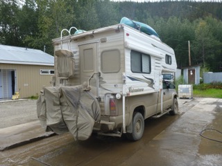
Parts of this highway were quite brutal with ruts, potholes, washboard, and always – mud! From Chicken to the turnoff to Eagle was the worst, and that was followed by brand-new pavement to the border crossing. From there to Dawson City the road was mostly good gravel, but still very muddy. By the time we arrived at our RV site in town for the night, Truck House had become disguised as a rather boxy mud-pie! Eight dollars later, we had spray washed most of the muck off, and once again looked respectable.
Road paint from “Top of the World”
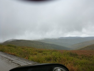
We are still in that weather system that provides gloom and showers – sometimes heavy. We are sure that some of the viewpoints on the “Top of the World” highway are truly spectacular, but we could only imagine. Fog was also heavy at one point, but we were able to see and experience the vastness of the “Chicken Fire” that occurred in 2004. For miles, and several hours we were within the fire-ravaged territory, and we began to get a shocking concept of the 1.3 million acres that burned!

The “Chicken Burn” of 2004
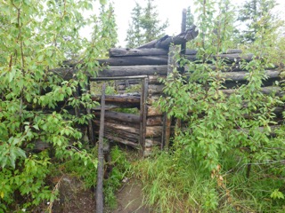
Trapper cabin near summit at Top of the World
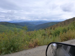
Looking north into Yukon from “Top of the World”
We did stop at Chicken, and were directed to a cafe that featured baked sweets. Unfortunately, a cruise ship tour bus (where did it come from???) beat us there, and we had to join the crowd in line before getting a superb and huge cinnamon bun. This was about 10:30, and became our sustenance until supper time.
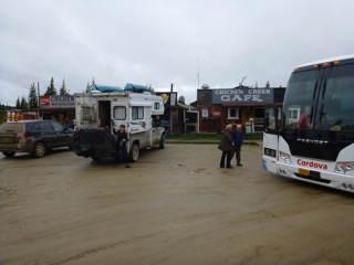
The Tour Bus hits “Chicken”
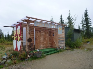
The “Chicken Poop”
Dawson City is an intriguing view into our gold-rush history. Some of the original town has been preserved – in the original – decaying and sinking into the permafrost. Other parts look original but are reconstructions.
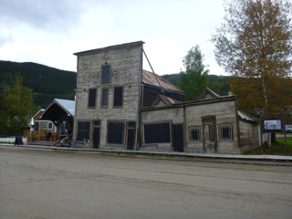
Permafrost gradually lets buildings down
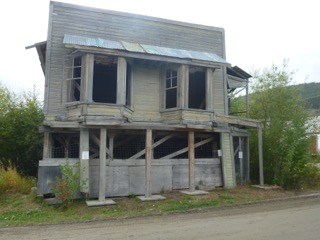
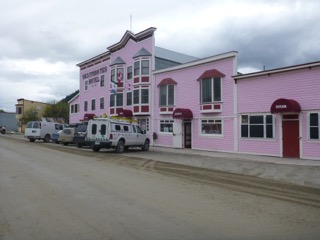
Last night, we took in the Diamond Gertie Casino show. It was entertaining, but Sandy and I voted it second best to the Barkerville Revue that we watched several years ago with the Lindsay and Mjaaland families. (The Barkerville performance by brother-in-law Lars was much superior to the “volunteers” at last night’s show!)
Today, hopefully in sunshine, we will stop at the Robert Service cabin, and then begin our trip south. The magnet of home begins to pull, and weather has caused us to shorten our itinerary considerably.
We are continually grateful for all the comments, and the emails. Thanks to all!
Love and best wishes to all!
Tony and Sandy
Tuesday, August 18 – “Baby, the Rain Must Fall, Baby the Wind Must Blow!”
Hello again, dear family and friends!
To your relief, I am sure, there is not too much to report since we left Kenai Peninsula. The title above kept ringing in my brain yesterday and today. (Song by Glenn Yarborough.)
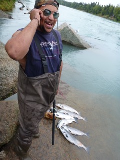
A young man in Soldotna displays his sockeye catch. (3 caught in 10 minutes that we watched.)
The rain that began there has followed us for two days (we stopped one night in Trapper Creek), and though we managed to outrun the edge of the large system by the time we got to the Visitor Center in Denali National Park, still we were in heavy weather prior to that, and hopes for seeing Mt. McKinley died. However, the rain stopped for our drive up to the end of the public access road in Denali, and the park was very beautiful. We also watched the movie in the Visitor Center, and saw most of what we could see yesterday.
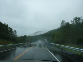
Road conditions heading north from Kenai Peninsula
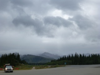
Weather conditions for most of Monday.
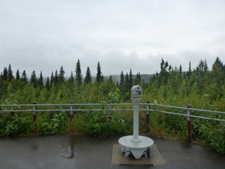
Mt. McKinley, as we saw it!
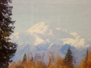
Mt. McKinley, as others see it. (Lifted from a pamphlet.)
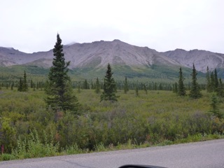
Denali Park near the end of the public access road.
In Healy, just north of the Park, I stopped for fuel, and used Roada to locate another quilt shop – Grandma’s Quilt Shop. She (Roada) took us through a dry river bed with huge potholes thinking that it was a road. We finally located the shop only to discover that it was closed on Mondays. Oh well! Later, in Fairbanks, on the internet, I also learned that we were a mile of two from the road where Chris McCandless disappeared “Into the Wild” and later died – possibly after suffering severe nerve damage from eating the seeds of the wild potato plant while in a state of protein deficiency. (The movie is about to be released and the young actor has been sentenced to 2 weeks in jail for assaulting a young woman at the Sundance Film Festival. And that, is the news!) The book by Jon Krakauer, “Into the Wild”, is a very good read.
Anyway, back to the road… We passed up all scenic “photo opportunities” since they were a waste of time until we reached the summit above Fairbanks. The sun came out, and by the time we were settled in to our beautiful site at River’s Edge RV, we were able to get back into shorts and lounge in our anti-gravity chairs beside the lovely Chena River for an hour or two. However, the weather system caught up with us again and the temperature dropped as the clouds moved in. By morning today, steady rain was once again our current and forecasted outlook.
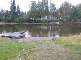
Tuesday morning at our Rivers Edge site.
Since my dashboard indicator was indicating time for oil change, we went into Fairbanks Chevy but because of the camper, we were directed to H&H Auto Service just around the corner. An hour and a half later – with a chatty time in the waiting room with folks from California – all was serviced, oil changed, air filter replaced, and we were once again ready to get on our way. One last stop – the Visitor and Culture Center. This is a magnificent building with tons to see and read. The displays are beautifully done, and there are a number of natural and historical movies that can be seen if you hit the right time of day. (We didn’t!)
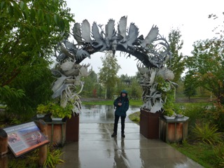
The “Antler” Arch beside the Visitor Information and Culture Center in Fairbanks.
Three and a half hours later, much of it in torrential rain, we are now settled at Tundra RV in Tok (“toke” – remember!) Tomorrow we will tackle the “Top of the World” Highway through Chicken to Dawson City. We can expect very muddy conditions! By the way, we read in one of our pamphlets that when the folks of that town were trying to decide a name for their settlement, they wanted to call it “Ptarmigan”, but no one knew how to spell that so instead they called it “Chicken”. I love that story!
North again tomorrow!
Love and best wishes to all…
Tony, the Quill, and Sandy, the Quilter
August 15, 2015 – Addendum to Spitting Images
Sandy catches me with the ideal catch:
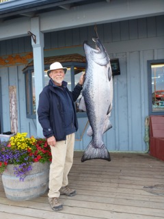
The catch of the day
Now I can move on…
Tony
August 15, 2015 – Spitting Images [aka Fishing at Homer Spit]
Late evening photos on Homer Spit (near 9:30 pm)
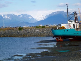
Beached barge and glacier in the east
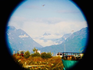
Zoom of glacier (through one lens of Binoculars)
Early morning on Homer Spit – wind during the night rattled the rigging hanging underneath our kayaks and made a periodic thrumming sound. It was most unsettling, but climbing out on the roof to attend to it would have been more aggravating. So we slept fitfully, and tried to ignore it. At daylight at 5:00 this morning (by the way, the sun set at about 9:45 last night), vehicles started arriving, fishers chatted softly outside our camper, the rain started to patter on the roof, and the bite was on!
By 5:30, the combat zone was marked out as fishers lined the beach casting towards each other from both sides of the creek that drained the small enclosed bay on the spit. As the tide fell in Kamchemak Bay, and the waters receded from the small basin, the fishers on the west side of the outflow creek stepped gradually towards their opposite numbers while the eastern side fishers in equal steps retreated. The only sound was from raucous, excited gulls.
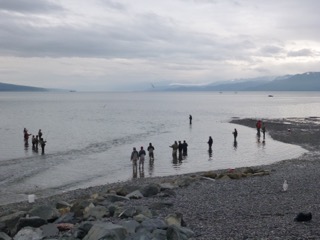
Homer Spit – fishing Combat Zone
Almost everyone is catching 7 to 12 pound cohoes, but I hang back, not anxious to join the fray. There is a rhythm and flow to the movement of the fishers, based on beach etiquette, space, casting directions, cast-timing and so on. When a catch is dragged up on the beach, the gap is quickly filled by returning fishers, or measured side-stepping. I am reluctant to put myself into the mix without a deeper understanding of the dance steps.
After several hours of watching the process in some astonishment, we retreated to Truck House for breakfast and coffee as the rain began again. As I look out the window at a very low receded tide, there are still a half-dozen die-hard casters out on the shoreline. This is less than a third of the number that were there an hour ago. I feel somewhat intimidated, and unsure – much like a teenager at a high school dance wondering about the risks of asking a pretty girl across the room for a dance – but the music has ended…and the rain is steady. And the last fisher has now finally left the dance floor.
Moving on…!
Tony, the Quill, and Sandy, the Quilter
A lunchtime stop in Kenai – in the rain:
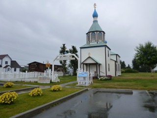
Russian Church in Kenai
 roadquill1